Google Rating
5.0
Based on 44 reviews
Mile High Aerial Photography
5.0

Perry Homes
1781046255
We had a fantastic experience working with Jayden. The photos were beautifully composed, professionally edited, and truly showcased the quality and detail of our work.

Xantra.louis12345 Louis
1779437953
Highly recommend Mile High Aerial Photography! The quality of the photos and drone footage was absolutely amazing and the turnaround time was super quick. Very professional, easy to work with, and great attention to detail. The final content really helped showcase the property perfectly and made it stand out online. Will definitely be using their services again!

Joel Anthony
1778190030
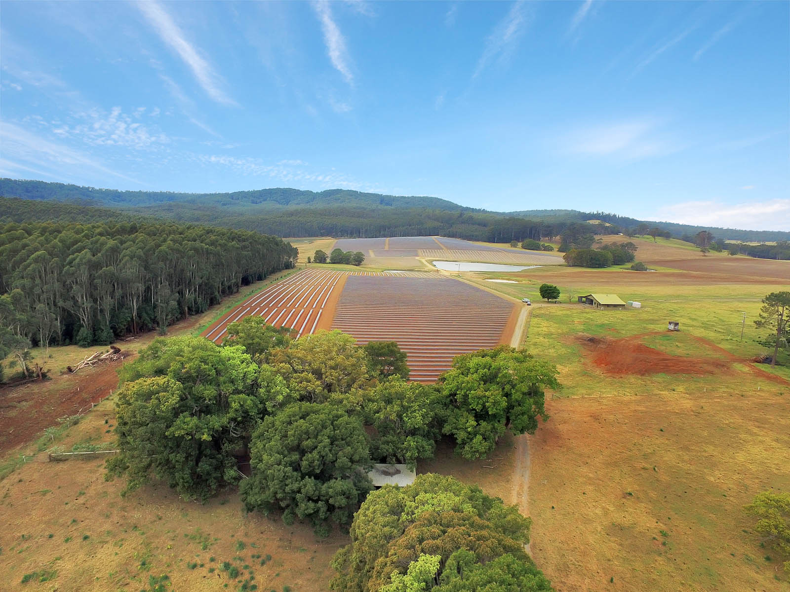
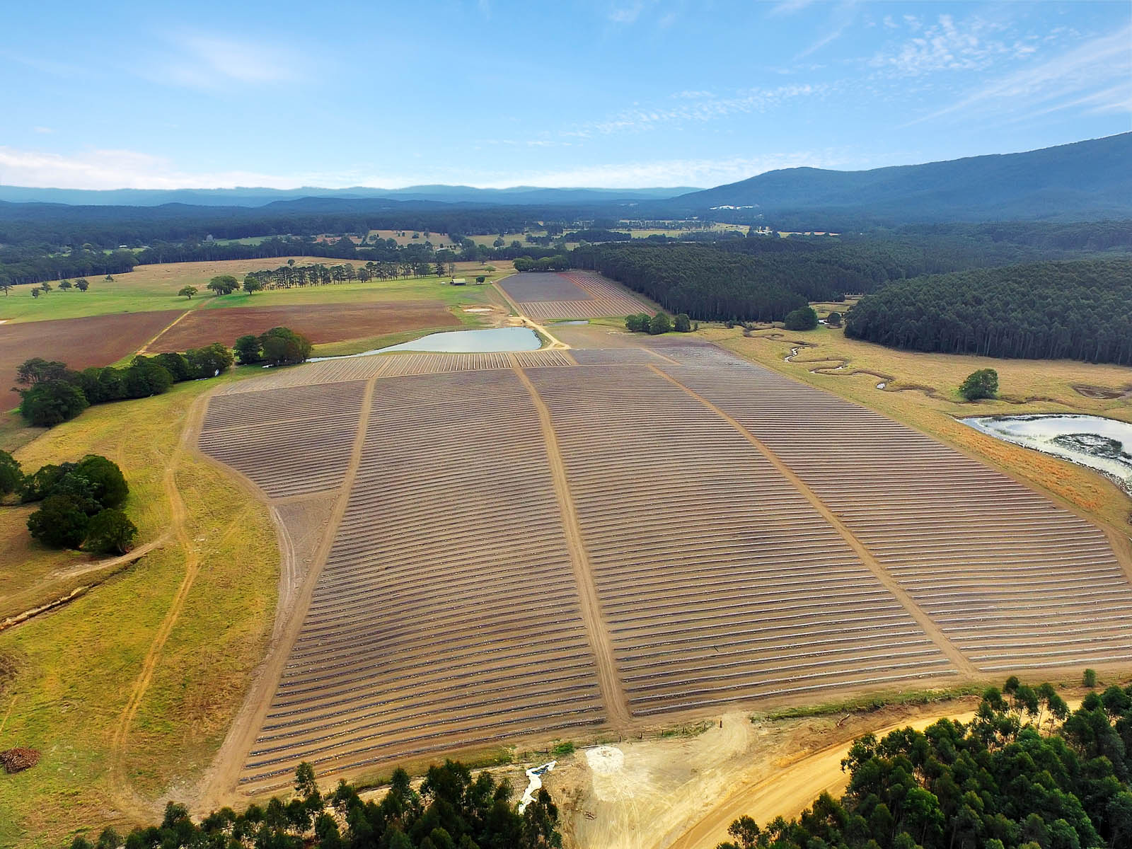
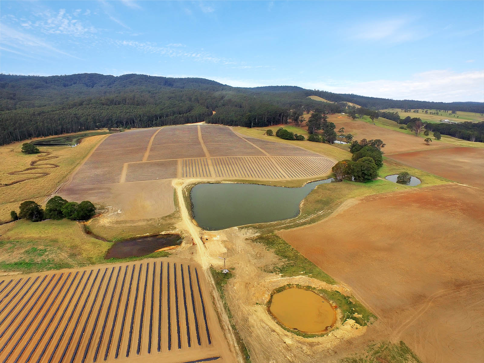
We recently worked with Jayden from Mile High Photography for photography of our development site and could not be happier with the result. Jayden was professional, easy to work with and had a great eye for capturing the scale and potential of the property.The aerials and overall presentation were outstanding and really helped showcase the site in the best possible way. Fast turnaround, excellent communication and high-quality work from start to finish. Highly recommend Jayden and the team at Mile High Photography.

Dan
1777976469
Mike High are absolutely phenomenal to deal with. They are exceptional at what they do. Highly recommend.Thank you for delivering on what you promised.

Cody-lee Read
1774255746
Absolutely love Mile High Aerial Photography!The shots turned out even better than I imagined so crisp, detailed, and taken from the perfect angles. They made the whole property look incredible and really stand out. Super easy to deal with, friendly, and had everything delivered so quickly. I’m honestly so happy with how it all came out and will 100% be using them again!

Spanline coffsharbour
1765404024
Did a great job on a project that we had just completed :) Cant wait to use them :)


Jose Porcia
1765239789
⭐️⭐️⭐️⭐️⭐️Mile High Aerial Photography delivers excellence every single time.Jayden, is professional, reliable, and incredibly gifted—he captures views that most of us could never imagine, and somehow makes them feel deeply personal. His work doesn’t just show a place; it tells a story.I’m grateful for his skill, integrity, and the way he brings our community to life from the sky. Highly recommended.


Bentleigh Motor Inn
1765234227
Great Service with a smile. The room photos including aerial photos & video that Jayden provided for the motel were just perfect and exactly the professional images that we asked for. I can strongly recommend Jayden & Mile High Aerial Photography for any occasion.
")
Gerson Rangel (gee)
1763941241
Jayden has done work for our businesses for the last 9 years. We would highly recommend him for your aerial and ground photography needs. Cheers

Jacqui Jordaan
1763005379
Highly recommend Mile High Aerial Photography, Jayden is absolutely amazing with his work. He is professional, friendly, flexible and accomodating. He will keep you updated every step of the process and happy to amend until you are satisfied. Photos and video turned out beautifully and to our expectations/standard. Thank you so much again Jayden!

Matt Jolly
1762300370
Jayden is my go-to guy for everything related to real estate photography. Always super happy with the results and can highly recommend.

Taj Dosanjh
1762027836
Couldn’t recommend anyone else for the jobFast, prompt and professional service5 stars !🌟

Jacko Mary
1761990062
We’ve worked with Jayden previously for our business marketing images and the results were exceptional. His professionalism, eye for detail, and ability to capture exactly what we envisioned made a huge impact on our brand. We wouldn’t hesitate to use Jayden again — highly recommended.

Joann Gutierrez
1761987053
I have seen Jayden photograph multiple houses, resorts, and commercial projects, and his work is consistently outstanding. He's always extremely professional and goes above and beyond to deliver the highest-quality results. If you’re looking to market your property or showcase your project, I highly recommend Jayden from Mile High Aerial Photography. You will not be disappointed.

My sweetest Dreams
1761987004
Jayden from Mile High Aerial Photography is an exceptional photographer who consistently delivers high-quality, professional imagery.His attention to detail and creative eye ensure outstanding results every time. Jayden’s customer service is second to none, making the entire experience seamless and enjoyable.

Leanne Watson
1761947642
Jayden listens and takes notes of your requirements. He then delivers. Great customer service

Tim Edwards
1754723787
I would highly recommend Mile High Aerial Photography to anyone, they did such an amazing job and the quality of both the photos and drone video footage was incredible.

Peter Mortimore
1754720241
Jayden was extremely professional in the numerous times I have used his services.Always punctual and well presented, he approached the task at hand with great sincerity.The final product was always above expectation and presented on time.I have no hesitation in recommending Jayden, a great communicator and very decent fellow.


jasper crisp
1730421005
We just had Jayden from Mile High do some drone and still shots for one of our construction projects and couldn’t be happier with his services. Would highly recommend.

Craig Stone
1727249226
I highly recommend Jayden and his Mile High Photography business.He’s extremely professional and we would use no other photographer for our real estate business.Prompt with great communication, quick turnaround times, and he really knows his stuff in the ever changing world of digital photography, legislation re drone usage etcAnd he’s a nice guy who has been a real asset for our business.We wish Jayden well in the future

ben horvat
1727233362
Jayden from mile high aerial photography was absolutely amazing, I highly recommend him and their company ! He went above and beyond on the photography for my property going on the market and was fantastic in every way ! He had great ideas and put in so much effort to get the best outcome for us ! Thanks again Jayden !!

Rich McKeon
1725923549
Jayden is a very professional drone and ground photographer that delivers great results every time I use him.

Gurminder Saro
1725243703
I have worked with for 4 years now, he is so easy to work with and very professional. Jayden is always on time and is invested in each project as if it were his own. Highly recommended and the qaulity of work is fantastic.

Ali Benefield
1725139491
Highly recommend Jayden Read from Mile High Aerial Photography. Amazing service, communication & photos.
")
David Ney (David)
1724978764
I am very pleased to leave a review for Jayden. He is professional and truly a gentleman. He takes pride in his work and this shows in the professional results. His experience and his equipment is second to none. I wholeheartedly recommend him to anyone who is interested in improving their chances at a good results realestate sale.


Mj Estill
1724323629
Jayden from Mile High Aerial Photography has done drone photos for me and my husband. They were amazing.He does an outstanding job.👏👏

Carly Marshal
1724321677
Really great work was very happy with the result fabulous shots Will definitely be using in the future

Ayden Wear
1724068423
We recently had some photography and videoography done for out business and the work was excellent!! Price was more than fair. Jayden was a dream to deal with, very thorough and we achieved our project to the highest of standards. Well done Jayden and thankyou for your work. Highly recommend Mile High!!

Kelly Rynk
1724057061
Jayden's attention to detail, patience, understanding, skill and vision ensured a 5-star experience and result. I absolutely love the video and pictures he presented and can't recommend him highly enough. He went over and above (no pun intended!) Thanks Mile High!!!

aquila clarence
1708732373
Jayden Read from Mile High Aerial Photography is an amazing highly professional teacher. Jayden helped my son and l purchase a drone suitable for our needs, helped us organise the tech equipment on computer via Photoshop and tablet to watch footage while on the ground with exceptional skill. He has a lovely gentle informative, thorough and efficient way of educating others about drones and photography. I highly recommend him and truely appreciate his help as it is my favourite recreational.pursuit, nature photography.

Micah Trivett
1708660521
Mile high did a such a great job taking photos of my business and very professional. Thank you

Ellen Morrison
1708394237
Thank you for a wonderful work you have done for us. I really loved it. You've done an excellent job. Highly recommended!

Garry Wynands
1708388147
Commission Mile High for a project. Highly recommend them. Tha sevice, communication and high-quality of work was fantastic. If you want your job done right, this is the company to use

Vikram Atwal
1708387885
Awesome service from start to finish with such high quality.Highly recommended


Korora Bay Village Resort
1628657162
Always great images produced. 2nd time we have used this service and they captured the resort perfectly. Very easy to work with and flexible. We highly recommend this business.


×